
Find information on how to make a Protected Disclosure under the external procedures in place in the HEA.
Find information on how to make a Protected Disclosure under the external procedures in place in the HEA.
INSPIRE is a €750 million investment package that will address research infrastructure needs across the higher education sector while ensuring alignment with national research and innovation priorities.
Tracking graduate outcomes is crucial to improving the quality of education for students and outcomes for graduates.
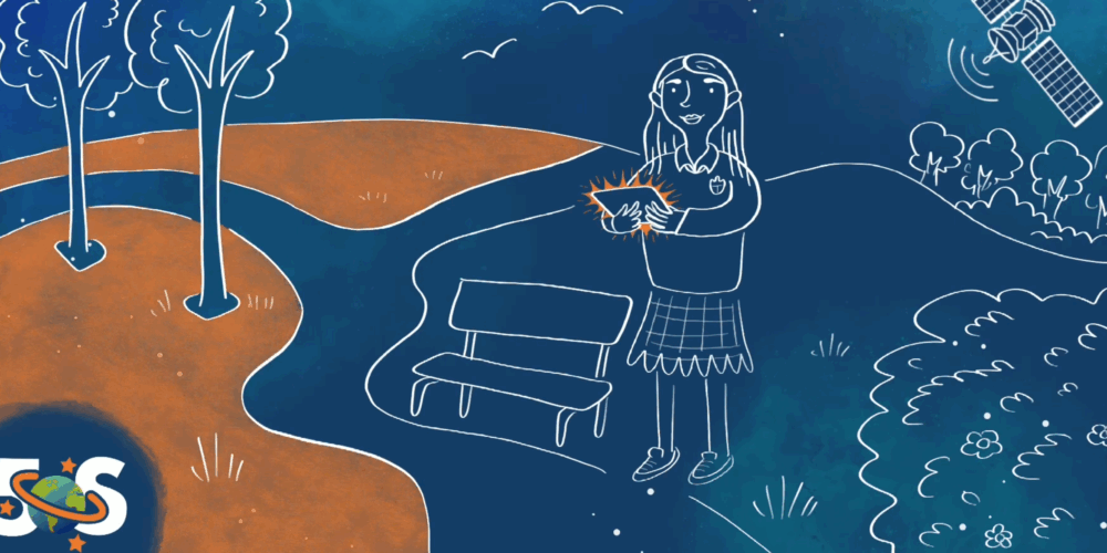
Transforming STEM Education with Satellite Data and SDG Integration
The 5*S (Space, Surveyors & Students: STEM and the Sustainable Development Goals) project is a collaborative science outreach initiative funded by Research Ireland (formally Science Foundation Ireland) and led by the Departments of Geography and Education at Maynooth University, in partnership with Technological University Dublin, Tailte Éireann (formerly Ordnance Survey Ireland), the Society of Chartered Surveyors Ireland (SCSI), and the Environmental Systems Research Institute (Esri) Ireland. Each partner contributed to this project with their expertise and resources, culminating in an innovative, national outreach programme.
The project’s purpose is to connect students and teachers with real-world applications of space science, geography, and sustainability through engaging interactive tools. By integrating STEM and SDG themes in a relatable and interactive format, 5*S promotes spatial literacy and upskilling while encouraging students’ progression in geospatial related pathways, addressing a growing societal need.
We launched our research-grounded project in 2020, with the aim of providing spatial skills training, enhancing success in STEM (Science, Technology, Engineering, and Mathematics) fields for both students and teachers across Ireland. Our unique approach applies satellite-based spatial data analysis to real-world challenges, using virtual reality and the Sustainable Development Goals (SDGs) framework to support learning and STEM capacity.
The initiative benefits from two existing national school-based programmes – the ArcGIS for Schools Programme from Esri Ireland and the Day in the Life from the Society of Chartered Surveyors Ireland (SCSI) – along with the SDG GeoHive data-portal, which was developed in a partnership between Tailte Éireann and the Central Statistics Office (CSO).
The Phase 1 of the project (2020-2023) included working with community groups to co-create real-world SDG relevant scenarios as training content (called StoryMap). These contents enable students to engage with spatial narratives and data analysis in a visually compelling format. In total, we developed nearly 155 StoryMaps, which are currently available to the public. One example that focuses on SDG challenges is the ‘Zero Hunger’ StoryMap, regarding the 1840s Irish famine. We designed this scenario in collaboration with Skibbereen Heritage Centre to demonstrate how effective data can be used to ensure that this will never happen again.
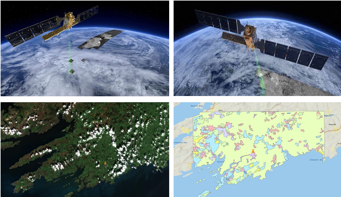
Figure 1: Example of a StoryMap training content focussed on food security – i.e. SDG 2 Zero Hunger
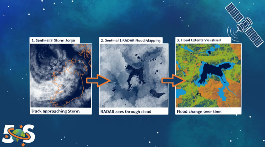
Figure 2: Another example of a StoryMap training content focused on extreme weather monitoring – i.e. SDG 11 Sustainable Cities and Communities
Over the years, we have developed and delivered a range of activities through the 5*S project that were designed to make spatial data science accessible and inspiring for learners. Central to the project’s approach is the delivery of interactive classroom workshops, which use real-world satellite imagery, digital mapping tools, and Augmented Reality mobile technology to explore themes such as climate change, renewable energy, and sustainable cities. Through these workshops we aimed to enhance cross-curricular key skills in Irish schools such as numeracy, literacy, communication, creativity and thinking. We also co-designed teaching content with the support of Junior Certificate teachers, using Esri’s ArcGIS Online platform. These resources are free to all schools and can be adapted to suit different educational settings and student needs.
In alignment with broader goals of promoting empowerment and social inclusion to a more equitable and diverse STEM landscape in Ireland, we worked with industry partners and leveraged the SCSI Education team to focus our outreach on schools in the Delivering Equality of Opportunity in Schools (DEIS) programme and on female students. We worked with partners such as the MU Outreach Office and TU Dublin’s “Students Serving the Community” programme to support and prioritise these targets groups.
To extend our reach beyond workshops, we also developed the SatelliteSkill5 Augmented Reality mobile app. This app offers students an immersive and interactive learning experience and enables users to solve community challenges using real world datasets. We made the app freely available on PlayStore and AppStore, offering eight functional games – each one relating to a different SDG challenge. These resources were targeted at the Junior Certificate curriculum as an alternative form of Classroom Based Assessment (CBA). The app also allows students to share their performance data with educators, providing them with actionable insights to support progress evaluation and their understanding of SDGs and spatial data.
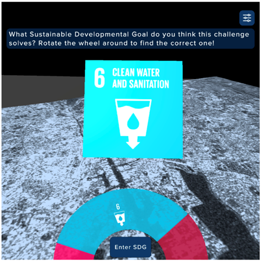
Figure 3: Example of the SatelliteSkill5 app interface teaching students about the SDGs using satellite data and a water quality challenge in Dublin Bay
Recognising the importance of teacher empowerment, we prioritised Continuing Professional Development (CPD) by offering both in-person and online workshops for teachers and student teachers across Ireland. These sessions focused on building confidence in the use of digital mapping tools and on integrating SDG-related content into teaching practice. 5*S successfully trained over 180 science student teachers to integrate satellite data into their lessons and to design their own StoryMaps, directly aligned with the Junior Cycle Science curriculum. This interdisciplinary approach served as an exemplary model for initial teacher education programs, and all science-based StoryMaps created as teaching materials are available for use by other science teachers.
Evaluation has been central to our development process. Before we launched our interventions, we collected baseline and benchmark data to support comparative analysis of the effectiveness of the project. To further assess success, we used mixed evaluation methods, including annual quantitative surveys and participant feedback.
In the first phase, we focused on teacher feedback and the quality of delivery. In the second phase, we introduced student voice as a key metric, exploring how the project influenced students’ understanding of STEM and their perceptions of satellite technology. This evidence-led approach has informed ongoing improvements and helped us maintain both sustainability and scalability. An external evaluation was also conducted, strengthening validation and reliability of our initiative and its assessment mechanisms.
Over the course of five years, we reached and engaged approximately 40,000 students and more than 300 teachers and student-teachers across 22 counties, highlighting our nationwide impact.
With over 155 StoryMaps and 14,000 downloads of our SatelliteSkill5 App, 5*S offers students a unique and interactive introduction to satellite data and its real-world applications. Participating students have highlighted that both the workshops and the App are enjoyable and eye-opening. Many reported an increased interest in STEM subjects and greater awareness of career paths they had not previously considered. Student opinions helped us verify the value of the sessions:
Our resources and activities have supported the integration of spatial science into everyday classroom learning, often for the first time, and we have made clear the links between space technology and the pressing sustainability issues affecting communities in Ireland and beyond. Following our intervention, teacher confidence in teaching satellite-themed content nearly doubled, and 98% reported satisfaction with the training received.
Each school that participated in our programme nominated a representative teacher to act as an ArcGIS Online administrator with Esri Ireland through the ArcGIS for Schools programme, disseminating knowledge to colleagues and helping them in running experiments. Through this approach, we extended the reach of our impact and supported the use of STEM across other subject areas.
Our visibility and recognition have also continued to grow. The Irish Government selected the 5*S project as a national case study for its voluntary review to the United Nations on progress towards achieving the 2030 Agenda for Sustainable Development, highlighting its ability to connect education, research, and public engagement in support of the SDGs.
Through a creative and collaborative model, we have demonstrated how sustained outreach can empower students, support teachers, and build national capacity in spatial and environmental literacy.